What is a IMWP?
An integrated watershed management plan outlines actions to address priority land and water resource issues on a watershed basis. The plan is a tool to assist residents, stakeholders and all levels of government in making responsible decisions on how to manage water, develop land and allocate resources within the watershed. Each stakeholder in the watershed has a role in ensuring that this watershed plan is successfully adopted and implemented.
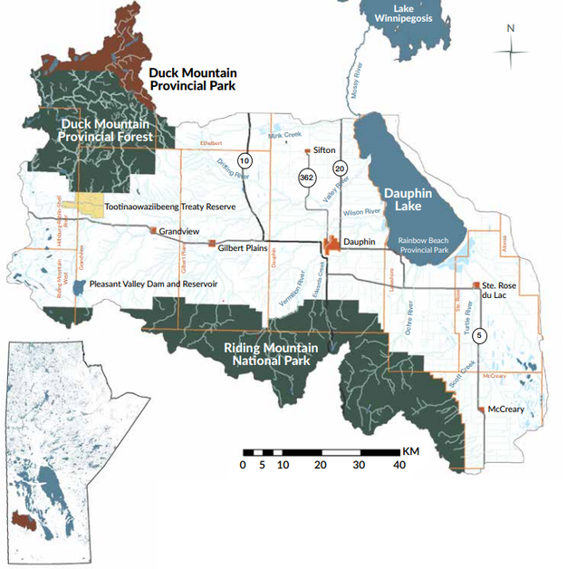
Dauphin Lake IWMP
One of the largest watersheds in southern Manitoba. |
|
Diverse Topography such as:
Priorities of:
|
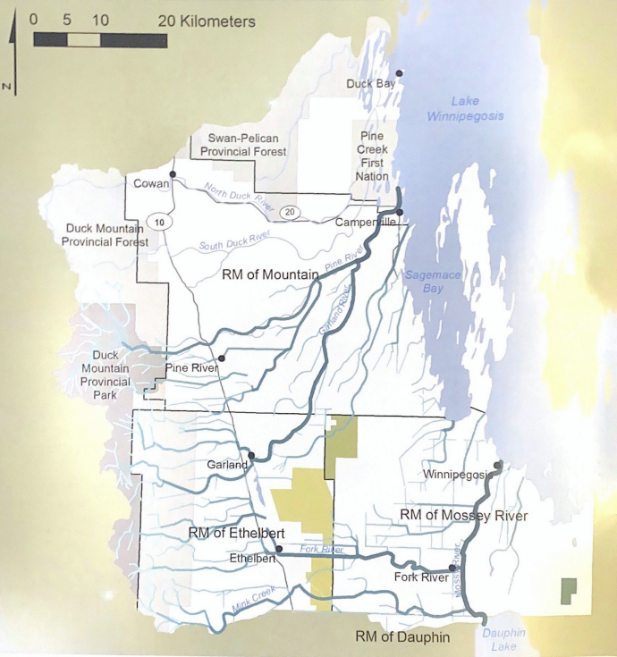
East Duck Mountain - Sagemace Bay IWMP
|
Approximately 1,660 sq. mi (4,300km²) in size. The Primary land cover is Forest (combination of Deciduous, Mixed wood, Coniferous) Using satellite imagery:
|
|
3 Goals:
Did you Know? The East Duck Mountain - Sagemace Bay Watershed is the steepest sloping watershed in Manitoba. It ranges from the highest point in Manitoba, Baldy Mountain (832 metres above sea level) to Lake Winnipegosis (254 metres above sea level). |