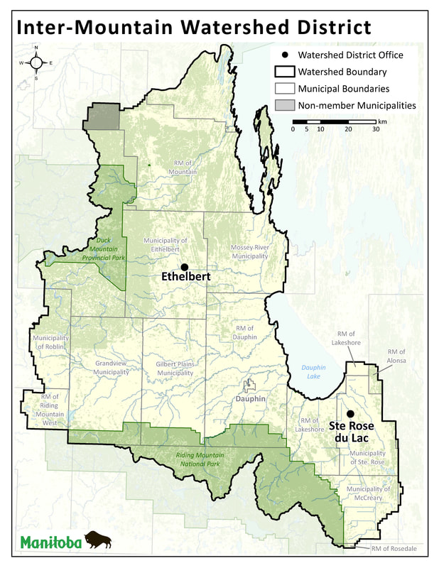
IMWD Boundary
Being one of the largest Watershed Districts in Manitoba, Inter-Mountain Watershed District covers a total of 12,508 km² of diverse topography. The district includes Pine River, Sclater River, Duck River, Fishing Rivers, and Mossey River subwatersheds which flow to Lake Winnipegosis and the Mink Creek, Valley River, Wilson River, Vermillion River, Edwards Creek, Ochre River, and Turtle River subwatersheds which flow to Dauphin Lake.
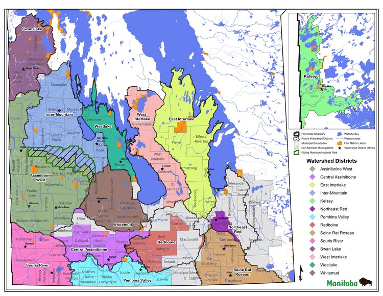
Watershed Districts in Manitoba
On January 1st, 2020, Manitoba’s 18 conservation districts became 14 watershed districts with the proclamation of the Watershed Districts Act. To reflect this change, Manitoba Conservation Districts Association (MCDA) has changed its name to the Manitoba Association of Watersheds (MAW).