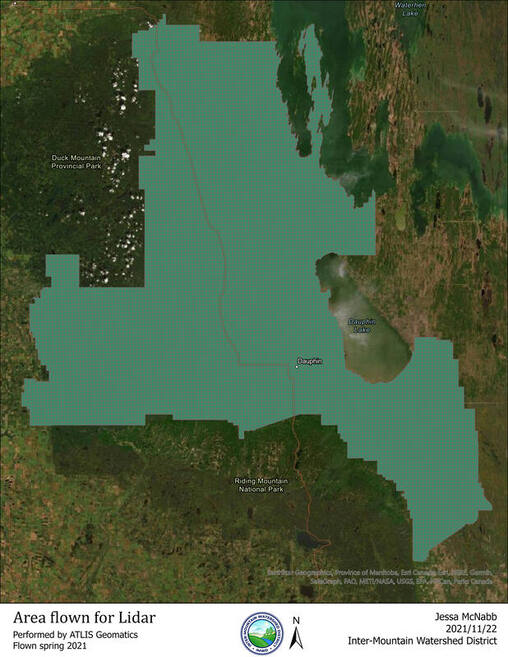
Inter-Mountain Watershed District (IMWD) has embarked on a project to collect highly accurate topographical data for our entire area. In spring of 2021, Attlis Geomatics flew over our fourteen municipalities, collecting data using Light Detection and Ranging (LiDAR) technology.
|
9365 sq. km in area |
Approx. 13% of Agro-Manitoba's land base |
Ground Elevations for the whole Inter-Mountain Watershed District |
Total Cost- $266,173 |
What is LiDAR?
|
Lidar is a method for determining ranges by targeting an object with a laser and measuring the time for the reflected light to return. The Lidar calculates land surface topography by emitting light beams from the plane, and then measuring the time it takes to reflect off he ground surface and return to the plane.
After the LiDAR data is processed, we will have accurate digital surface elevations for all land within our District. IMWD and our partner municipalities will then use the processed data for surface water management planning, enabling us to make proactive decisions for better protecting our area from flood damages. A good example of this would be using the data to find the most cost-efficient place to build upstream water retention, in order to protect the downstream infrastructure from washing out during a flood. Benefits of LiDAR dataWe will have accurate digital surface elevations for all land within our District. IMWD and our partner municipalities will then use the processed data for surface water management planning, enabling us to make proactive decisions for better protecting our area from flood damages.
A good example of this would be using the data to find the most cost-efficient place to build upstream water retention, in order to protect the downstream infrastructure from washing out during a flood. Some other examples include:
|
|